There is still a lot of model uncertainty with respect to the track and timing of the storm on Thurs. Pick any solution between the CGEM, GFS or ECMWF, it will still be messy.
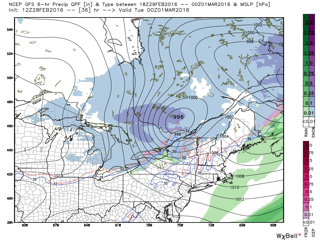
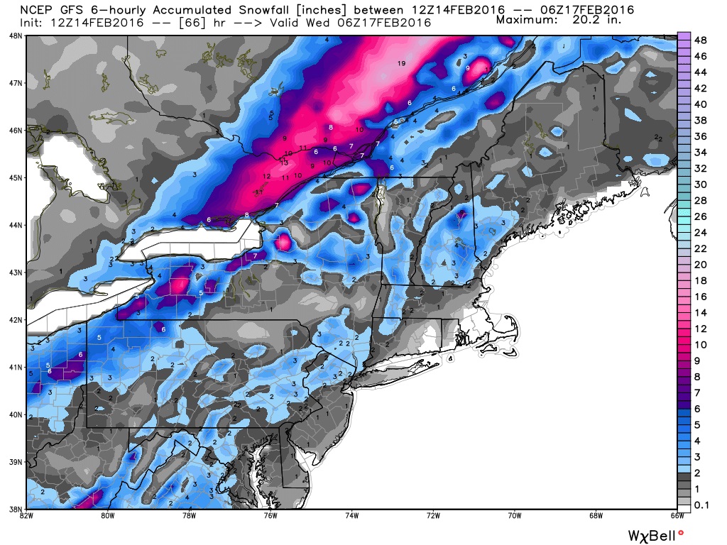
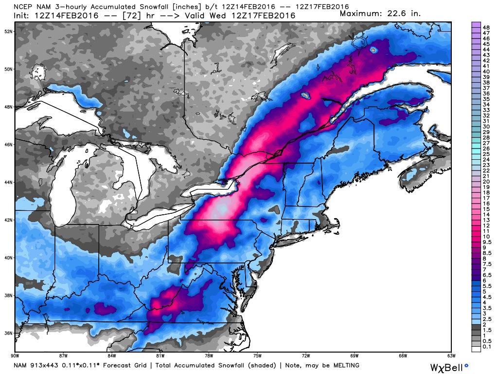
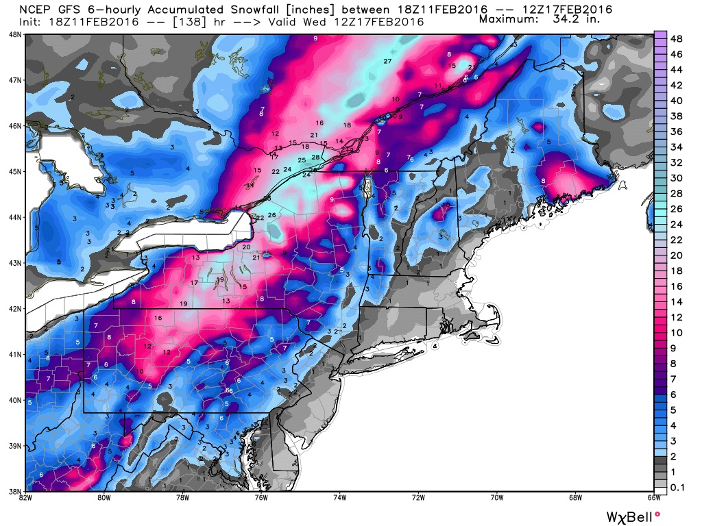
The GFS solution is the fastest and most northern of the three. The storm track in its solution has the storm center going over Lake Huron to just west of the Ottawa area by Thursday evening (map below). This track and timing allows the storm to get ahead of the coldest air aloft, causing little snow for the Ottawa area, but more of a ice mix to rain.
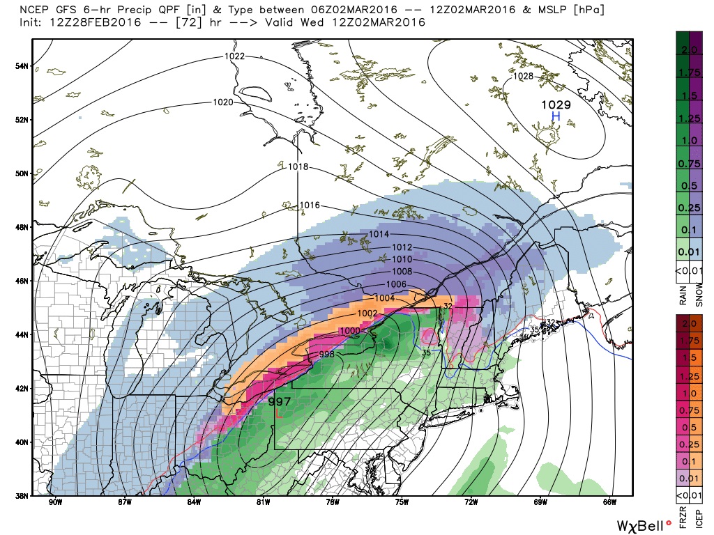
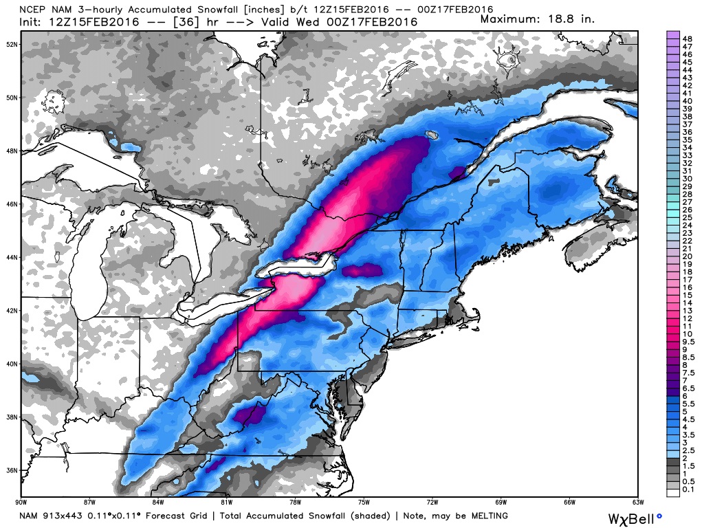
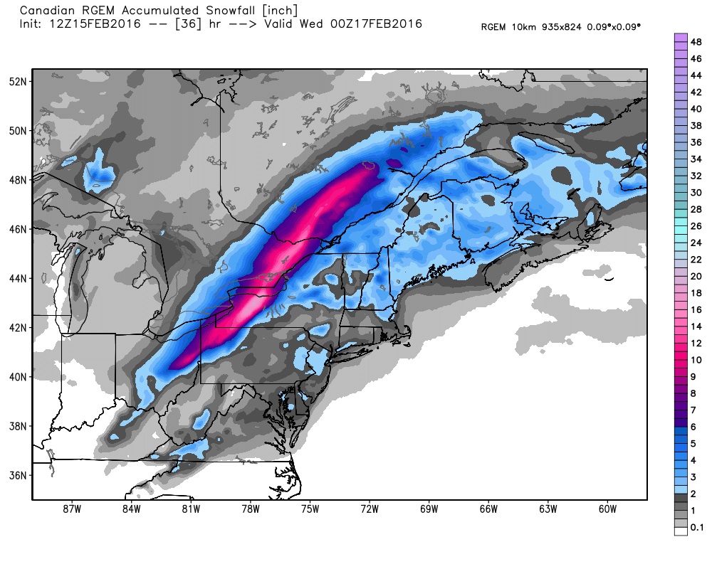
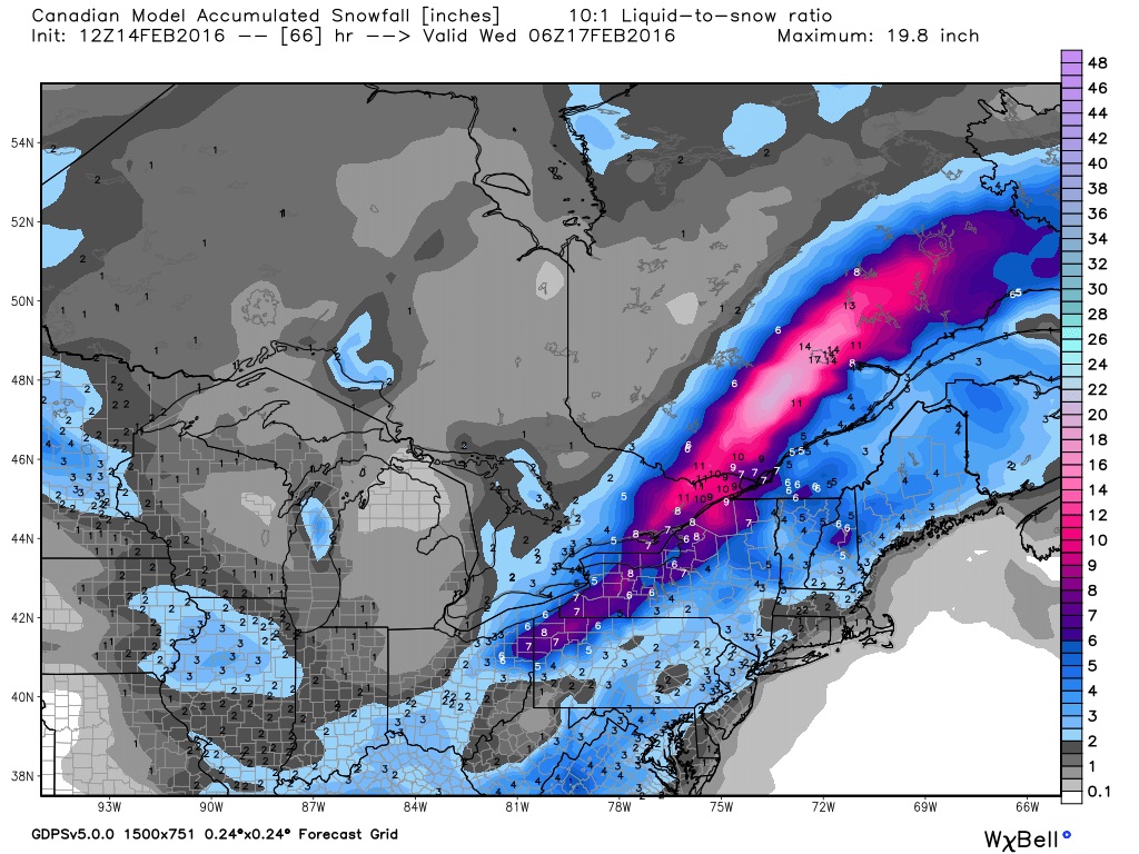
The CGEM solution has the storm center sliding over Lake Erie to just south of Lake Ontario with a slower track. Thursday evening it has the storm over Lake Erie (map below). This will give more snow and a brief mix of ice.
The ECMWF solution has the storm center going just south of the great lakes at a slower pace. It has the storm over Ohio Thursday evening. This give the Ottawa region mainly snow. Sorry, can't show any Euro maps.
So is the GFS jumping the gun or is the ECMWF dragging it feet? Will the CGEM come up the middle and be right for once? Stay tuned to find out.
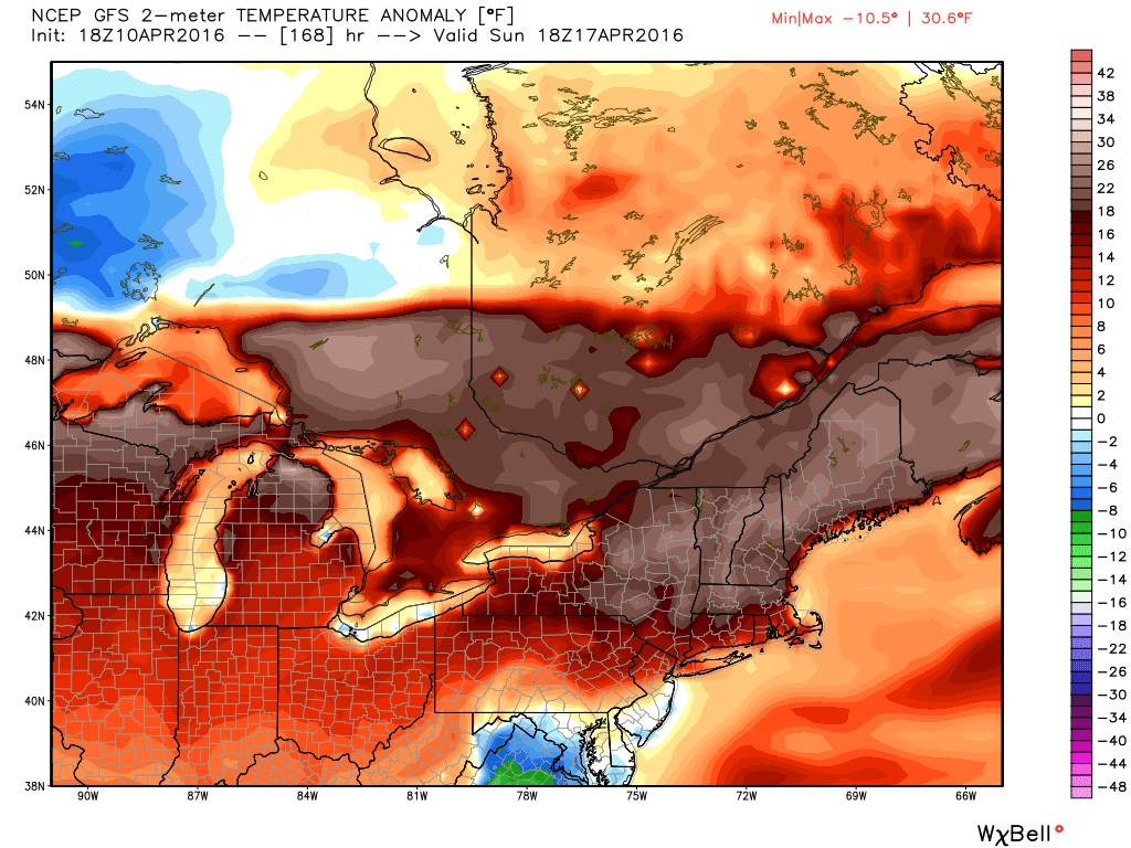
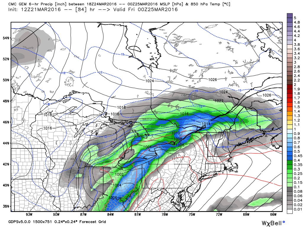
Maps courtesy of Weatherbell.